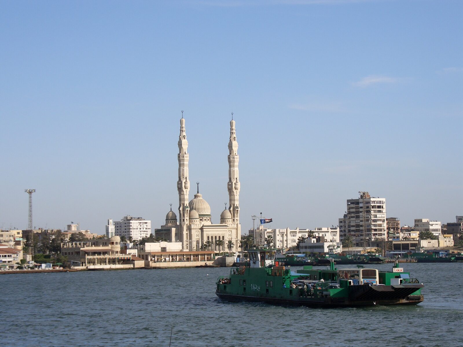
History of the Port Said ferry: a daily link between two banks
The crossing that connects two banks and generations of daily life
This page offers a historical background based on generally available sources about Port Said and Port Fouad, and explicitly separates what those sources say about the past from what can be confirmed about operation today.
This page offers a historical background based on generally available sources about Port Said and Port Fouad, and explicitly separates what those sources say about the past from what can be confirmed about operation today.
Visit tips
Allow time for both the crossing and a short look at the two urban banks; queues and operations vary.
Highlights
A working transport link with a social history
Views of Port Said and Port Fouad from the water
A direct way to understand the canal’s role in local life
About Ferry history
The ferry developed as a practical link between Port Said and the east-bank community of Port Fouad. Its story includes work journeys, family visits and changing infrastructure, and should not be confused with a verified current service timetable.
Basic information
Destination
Ferry history
Area
Port Said–Port Fouad ferry crossing, Suez Canal
Suggested visit
Allow time for both the crossing and a short look at the two urban banks; queues and operations vary.
Opening hours
For present-day crossings, consult current terminal notices and staff rather than historical accounts.
Ticket prices
Historic mentions of free crossings do not establish today’s fares or vehicle rules.
How to get here
Identify the correct current passenger boarding point on the Port Said or Port Fouad bank.
Follow staff directions for queues, boarding and return arrangements.
Discover the charm
History
The crossing helped knit the canal’s two urban banks together.
Engineering
Its terminals and vessels have evolved with the city’s needs.
Culture
Daily passengers make the link a living part of local identity.
Experience
See both skylines from a permitted passenger area.
Why the crossing became part of everyday life
The canal created a physical separation between the urban shores of Port Said and Port Fouad while economic activity, work and family life created a constant need to move between them. The ferry answered that everyday need. It is best understood as public infrastructure with a social history, even though visitors now also enjoy it as a short experience on the water.
This distinction matters: an excursion can focus on the view, but local passengers may be commuting, carrying goods or meeting relatives. Observing that ordinary rhythm respectfully gives a fuller sense of the crossing than treating it as a sightseeing ride alone.
The ferry as a lens on the canal
The view from the ferry links several layers of history at once. The canal represents a major engineered transport route; the two shores reveal different urban development; the vessels and terminals show how movement is organised today. A single crossing can therefore introduce geography, engineering, economics and everyday community life.
Terminals and berths have changed over time, and reports about construction or future improvements are not always evidence of a completed operational change. Historical descriptions and photographs should be used to understand former arrangements, not to choose today’s boarding gate.
A heritage-focused round trip
Begin on the Port Said side with a look at the public terminal approach and the west-bank skyline. During the crossing, notice how quickly the view changes as the two banks separate and recombine. In Port Fouad, allow time for one accessible street or waterfront viewpoint before returning. This gives the route a beginning, middle and end rather than a simple out-and-back ride.
Before boarding, verify the current service pattern, passenger requirements and return arrangements with staff. Vehicle procedures can differ from pedestrian boarding. Keep cameras and bags secure and allow everyday commuters to move without obstruction.
Recommended visiting route
Begin at the public ferry approach and read current notices.
Observe the terminal setting without interrupting boarding.
Cross while following crew instructions.
Explore a short east-bank street or waterfront segment before returning.
Visitor guidelines
Never infer a current departure time from an old document.
Keep clear of loading lanes and vessel machinery.
Ask staff about the final return and any changing restrictions.
Photography spots
1. Ferry at berth
Capture from a permitted waiting area.
2. Two-bank skyline
Show the contrasting shores from the crossing.
3. Everyday crossing scene
Respect passengers’ privacy while recording the atmosphere.
Where to stay
Staying near the Port Said terminal makes it practical to explore ferry history and the nearby landmarks in one day.
Visitor reviews
Read recent visitor experiences and check location details on Google Maps. Ratings and reviews vary over time and are not reproduced here.
Identify the correct current passenger boarding point on the Port Said or Port Fouad bank. Follow staff directions for queues, boarding and return arrangements.
Historical context: The founding of Port Fouad and workers moving between the canal banks.
Sources: Historical and general tourism material, not all of it dated.
Current status: No timetable, fare or boarding route can be inferred from history.
More from the original visitor guide
Why the ferry existed
The ferry was historically tied to the growth of Port Fouad on the east bank and to moving workers between the two banks of the canal, before becoming part of everyday city life. In that sense it is closer to social infrastructure than to an attraction designed for sightseeing.
This context explains why the ferry appears in historical writing about Port Said and in tourism itineraries as a free experience, while neither type of source provides current operating data.
Limits of the historical account
Documentary photographs and older reports describe different periods of the vessels and berths, and cannot be used to estimate present waiting times or facility conditions. Reports from 2026 about development works also do not prove that a planned project has opened or that a route has permanently changed.
Read this page as cultural background; questions about times, fares and gates belong to the guides dedicated to them.
Separate history from current operating status.
Do not infer prices or times from old tourism itineraries.
The available sources do not give a confirmed founding year; they describe the ferry as part of the history of Port Fouad and of workers crossing between the banks.
Was the ferry historically free?
Undated tourism itineraries mention it among free activities, but that does not establish a current tariff for any category.
Have the berths changed recently?
Official reports from 2026 describe works at ferry squares and berths, but do not confirm that a project opened or that one route is settled; check on site.
Choose whether to allow Google Analytics. Hosting-side technical processing and independently configured hosting analytics are separate from this choice.